Data processing
Our research on mapping techniques has lead to several processing workflows for the generation of 2D and 3D photomosaics, sonar mosaics and bathymetries of high quality, accuracy and resolution.

Our research on mapping techniques has lead to several processing workflows for the generation of 2D and 3D photomosaics, sonar mosaics and bathymetries of high quality, accuracy and resolution.

We have developed an automated system for optical mapping of the sea floor known as “photo-mosaics”. These photo-mosaics permit a global vision of large areas of the seabed in order, enabling large area scientific studies (archeological, biological, ecological, geological etc.) and engineering studies, such as planning the installation of underwater structures, oilrigs, underwater sewage pipes, etc.
The mosaicing technologies have been designed to allow both 2D and 3D mapping of the seafloor.
2D mosaicing employs image stitching based on robust motion estimation provided by navigation data and image correspondences. The motion estimation process is coupled with global alignment methods, resulting in globally and locally consistent 2D maps. The post-processing of the mosaics involves proprietary techniques for white point and exposure compensation, and image blending that ensure visual consistency and accuracy of the mosaics.
3D maps can be generated using visual data provided by either multiple cameras (stereo systems) or single cameras (monocular systems). The 3D mapping process can be aided by navigation data if available or can be carried out using image processing only. Our techniques combined with robust loop-detection and state-of-the-art global alignment techniques ensure high accuracy for the resulting 3D models.
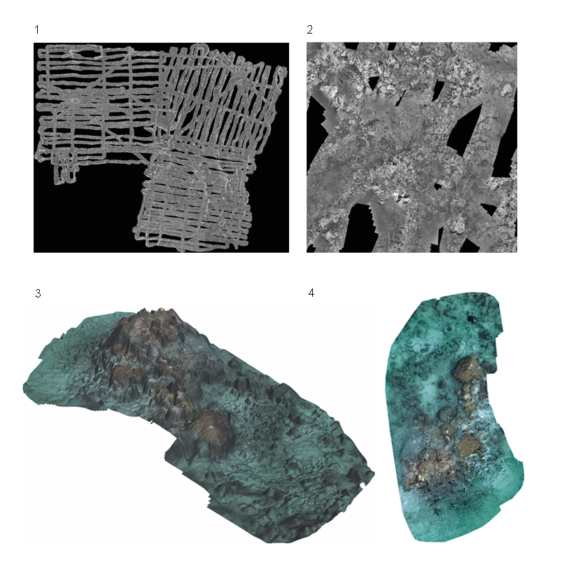
Using 3D mapping techniques, we have developed a ortho-mosaicing tool that allows the generation of 2D maps of areas that exhibit high 3D relief and hence cannot be accurately mapped using classical 2D mosaicing approaches.
1. Overview of a 5 GigaPixel 2D mosaic covering approx. 500 square meters. The visual data was acquired by the Victor-6000 ROV during the MOMAR08-Leg1 cruise (IFREMER/CNRS, France) at the Mid-Atlantic Ridge.
2. Part of the MOMAR08 mosaic, depicting the high level of detail of the mapping.
3. Example of a texture-rendered 3D model of a coral reef in Bahamas, part of a larger scientific study carried out by the University of Miami.
4. The 2D map obtained from the 3D model of the coral reef, using our ortho-mosaicing techniques.
[contact-form-7 id=”540″ title=”Contact form 1″]