Data processing
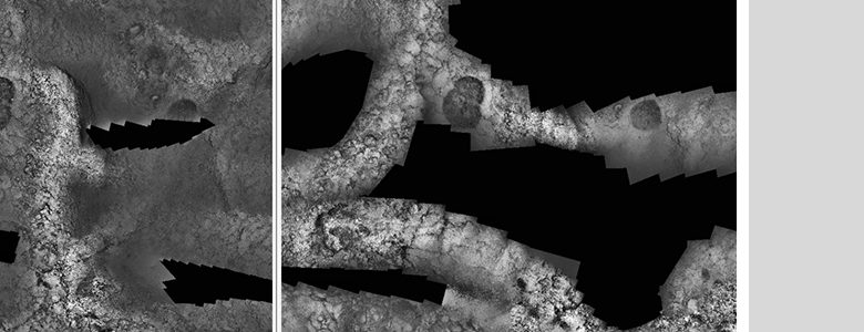
Our research on mapping techniques has lead to several processing workflows for the generation of 2D and 3D photomosaics, sonar mosaics and bathymetries of high quality, accuracy and resolution.
Our research on mapping techniques has lead to several processing workflows for the generation of 2D and 3D photomosaics, sonar mosaics and bathymetries of high quality, accuracy and resolution.

While several software tools are available for viewing georeferenced images, they cannot cope with very high resolution maps required for detailed seafloor studies. To overcome this problem, we have developed a software, called MosaicViewer, that allows automatic generation of georeferenced mosaics using the vehicle navigation information. Moreover, MosaicViewer can be used to visualize, extract data and information (e.g., plotting, digitization, georeferenced image extraction), and to compare mosaics of the same area collected at different times (i.e. temporal studies).
The mosaic building process is carried out by a set of Matlab tools that use standard navigation data and image file information to generate a GMML (General Mosaic Markup Language) file with the necessary data to create the georeferenced mosaic. The GMML, along with the images, are used by the MosaicViewer software to render the mosaic, which can be then visualized, compared, etc.
Photomosaics created solely from raw navigation data (i.e., scaling, rotating, and positioning of images) can be readily genereated, in a fast way and are adequate for most scientific purposes, as the resulting images are geographically registered, oriented, and scaled. For applications that require higher mosaicing quality and visual accuracy, additional processing can be carried out using our mosaicing software: image registration, global alignment, blending.
MosaicViewer was designed to efficiently exploit the computational resources. For this, we have designed it to use a multi-resolution approach: during the mosaicing rendering, a multiresultion pyramid is generated, allowing smooth visualization and manipulation of large mosaics even on low-end computers.
The software employs a simple and intuitive user interface. The list below provides some of the main functions available, which are described in detail in documentation released with the software:
[contact-form-7 id=”540″ title=”Contact form 1″]